Esri EADP19-001 ArcGIS Desktop Professional 19-001 Exam Practice Test
What is the most efficient way for an ArcGlS user to modify the projection for data in a non- standard coordinate system (undefined in ArcGlS) to align with data in a standard coordinate system?
Answer : D
An ArcGIS user has a project that requires using an image with a spatial accuracy of 5 meters Root Mean Square Error (RMSE) or better.
How should users verify the spatial accuracy of the image?
Answer : B
An ArcGlS user receives parcel data from the regional government, which is supposed to line up with parcels in the data maintained by the local government. The user is tasked with reconciling the discrepancies between the local and regional data.
In which situation are the parcel boundaries within the local data more likely to be accurate than the regional data?
Answer : A
Data in the state of Louisiana has the projection defined as WGS 1984 UTM Zone 15S. The user knows that this area of Louisiana is located m UTM Row S. When added to ArcMap with other data that draws in the correct location the data with the Zone 15S definition draws in the vicinity of the North Pole.
What is wrong with the projection definition?
Answer : A
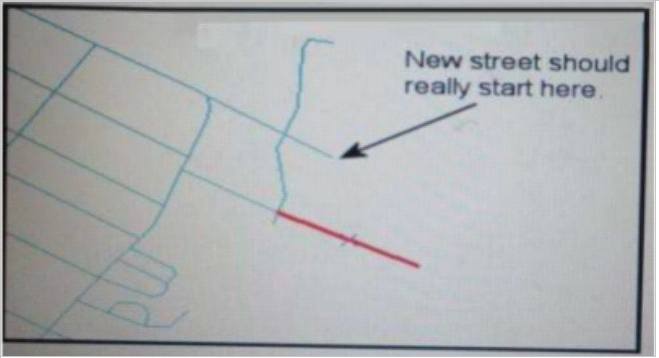
Refer to the exhibit.

An ArcGIS user added a new street (shown in the exhibit) to a streets feature class within an edit session.
The new street seems to have snapped to an existing street but upon zooming in the ArcGIS user notices that the street is connected to the wrong street.
What is the most likely reason for this error?
Answer : D
When is an ArcGlS user required to change the format of data before working with it in ArcMap?
Answer : A
An ArcGIS user regularly receives a large volume of data in shaped le coverage, and table formats. The user has a Python script tool for converting the data to a standard feature class format and writing it into a file geodatabase. The user schedules the script to run automatically, based on the update schedule, but the tool is sometimes unable to write to the database.
Why is the tool sometimes unable to write to the database?
Answer : A